Jan 28, 2016

First hike in 2016: Canoe Creek State Park

Canoe Lake is invisible under a layer of snow at Canoe Creek State Park.
Pennsylvania state parks host a series of "first day hikes" every year where groups of people walk trails at their local parks on New Year's Day. These hikes give people a different way of celebrating the New Year other than working off a hangover. They also help prevent the impending cabin fever that starts to set in after the winter holidays.

If you visit the Facebook pages of several state parks, you will find photos of people enjoying themselves on these first day hikes, mostly because no snow had fallen yet, and the temperatures in Pennsylvania were in the 30s. What you won't find in those photos is me, because I didn't go on a first day hike. I had the option because Canoe Creek State Park hosted one, but I had work that day.

Instead, I decided to take my first hike of 2016 on the weekend of my birthday (Jan. 23). That happened to be the same weekend of "Blizzard 2016," which blanketed much of central Pennsylvania in more than a foot of snow. Not far from Canoe Creek, in nearby Hollidaysburg, we registered about 16 inches of snow, and that's being generous.

Despite the forecast, some friends of mine suggested doing a "manly" hike during the snowstorm. We originally planned it for Saturday, but by the early afternoon that day, the storm buried most of our cars up to their doors. If I had forgotten where I parked my car the night before, I would have been screwed, because it wasn't even visible the next day.

Thank God I put my windshield wipers up.
Much better?
On Sunday, the snow stopped falling, and the sky, for the first time in weeks, was predominately blue with only a few clouds. My friend Ryan messaged me and said he was still interested in doing our hike. The weather looked a little more promising, other than the temperature, which was forecast to be in the mid-20s that day with a wind chill value of about 0. Regardless, I never hiked in deep snow before, so I thought it would be a neat idea.

Ryan picked me up, and we drove down to Canoe Creek. When we got there, we were the only car in the park. The snow in most of the parking lots looked untouched other than a road that was plowed about halfway down to the one lot. However, it stopped abruptly, leaving only enough room to park cars single file. We were unsure if we could park there, but we lacked other options. We parked and made our way into the park.

We found out that someone else was just as crazy as we were. Leading from our parking space was a set of footprints in the snow that went into the woods. I'm unsure where these footprints originated since, as I stated earlier, we did not see another vehicle at the time.

Walking inside these footprints made it easier to traverse through the snow. They eventually led to the edge of Canoe Lake, where they then went across it. This sounds more frightening than it actually is. About a week before the storm, the ice at Canoe Lake measured about 4 inches, according to local ice fishermen. That's usually enough to comfortably walk across ice without the threat of falling through it. By this point, the ice was probably twice as thick, and there also was nearly two feet of snow covering it. Ryan and I found out later when we crossed the lake ourselves that our feet barely touched the ice because the snow was so thick.

These are the footprints Ryan and I left when we crossed Canoe Lake.
The two of us ventured around the park for about an hour or so. We hiked over to the Blair Limestone Co. kilns first, where we crossed Mary Ann's Creek. Despite the snow and ice, the creek still flowed in some spots, which made for a peaceful sight on an already tranquil day.

Mary Ann's Creek at Canoe Creek State Park
After vising the kilns, Ryan and I then hiked to the Marsh Trail boardwalk, which runs along Canoe Lake. The snow hadn't been touched since the storm, so we had the honor of making the first footprints on the boardwalk as if it were the moon landing. Toward the end of the boardwalk was the Marsh Trail Observation Blind, which is a small hut with several glass-less windows that let you look out at Canoe Lake. The blind doesn't look like much during the summer, but when it's covered with snow, it's an image you would imagine seeing on a Christmas card from your relative in Montana who never talks to you otherwise.

Fresh snow covered the Marsh Trail Observation Blind and boardwalk.
The Marsh Trail Observation Blind up close
Our footprints on the Marsh Trail boardwalk give you an idea of how deep the snow was at Canoe Creek State Park.
When we walked inside the observation blind, we looked through the windows and got great views of Canoe Lake covered in snow. You could also see the nearby mountains incredibly well. I've been in this blind several times but never really appreciated it until this storm.

This window in the Marsh Trail Observation Blind looked like a painting.
When we were ready to return to the car, Ryan and I decided to cross the lake to get there. Just like the boardwalk, the snow on the lake was untouched in most places other than the lone set of footprints from nearby ice fishermen. During the summer, the lake is filled with boats, but now it looked like a desert in a tundra.

Pictured: Canoe Lake ... somewhere.
Once we made it back to shore, we walked to the beach/swimming area, which was also completely covered with snow to the extent that you could hardly recognize it. Just a few weeks before the storm, a group of people ran into the frigid water as part of a polar plunge for charity. There was so much ice then that it had to be chopped apart with axes so the swimmers could get into the water. Some of the participants even got cuts from the ice, according to my friend, Sean, who covered the event for the "Altoona Mirror." On this day, that water had refrozen over, and the snow covered any trace that people had swam there just three weeks earlier.

Who wants to go for a swim?
After hiking around the park for almost an hour, Ryan and I returned to the car. We thought we were crazy to go hiking in deep snow, but we found out other people had the same idea. Our car, which had been the only one in the lot when we arrived, was now in front of a line of about a dozen vehicles. As we drove out of the park, another four or five cars were just arriving.

Apparently cabin fever is rampant this year, or people in central Pennsylvania haven't had a good snow day in a while. I'd like to assume it's the latter, considering the last time I've seen this much snow was during the nor'easters in the early '90s. Whatever the reason, people embraced the best snow we've had in nearly 20 years. No matter the time of year, I'm just glad to see people outside enjoying themselves.

On a final note: Pennsylvania state parks are open year-round, and they're free. Screw your gym membership: Do your leg day on a trail, and work your muscles by doing pull-ups on a tree branch, just like God intended.

Jan 4, 2016

Outlook for 2016

It doesn't really feel like it's 2016 considering it's been warm enough the past few weeks to wear spring jackets and not get frost bite.

In fact, in the beginning of December, my girlfriend (Cassidy), my brother (Cody), his girlfriend (Melisa) and I visited Jim Thorpe Borough for the day and were able to eat lunch at Molly Maguires Pub & Steakhouse outside at a picnic table. Before we went back to Mountain Top, we snapped photos in front of a Christmas tree outside the train station. As you can see, I pulled off wearing a T-shirt that day it was so warm.

WE ARE ... experiencing climate change?
Regardless of temperature, the new year is here, and with each passing day, I'm going to be thinking of ways I can get outside and explore new places.

One added bonus for me this year is a kayak I got for Christmas, courtesy of Mama and Papa Yerms. It will give me the option of going nautical with my efforts. I'll be like Columbus, except everything's already discovered and easily searchable on Google Maps.

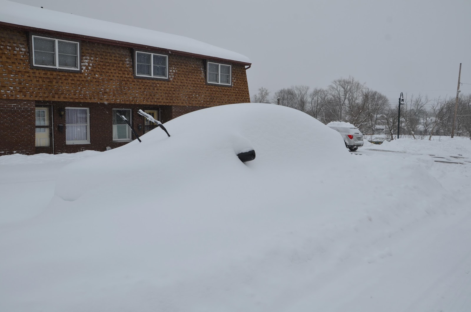
I bet Columbus didn't have mesh seats on any of his ships.
Even though I visited some neat places in 2015 such as the Delaware Water Gap and Warriors Path State Park, I feel as though my year lacked excitement compared to 2014. That year, I saw several different species of birds at the National Aviary in Pittsburgh, walked around underground in Lincoln Caverns in Huntingdon County and put my toes in the sand at Presque Isle State Park on Lake Erie. I also had two massive bike trails on my bucket list since 2014 but never set a tire on either.

I spent much of 2015 visiting sites I'm already familiar with such as Canoe Creek State Park and the Lower Trail -- both within minutes of my apartment -- and I didn't even get out to those places as much as I wished.

I have much larger expectations for 2016, however.

A few months ago, I bought a 2010 Toyota Corolla, which is in great shape and has awesome fuel economy (about 25 miles per gallon). My old 2001 Chevy Blazer guzzled gas and prohibited me from driving longer distances without throwing half my paycheck into the gas tank.

I also got a bike rack for my car. I used to stow my bike in the back of my car, which worked, but it was a pain to get in and out, making many bike trips more cumbersome than enjoyable. I can now transport my bike efficiently while saving on gas. All these new tools will make my travel and work so much easier now.

The great thing about Pennsylvania is that it has several hidden treasures, and like a pirate, I'm always eager to search for them (plus, it somewhat justifies my rum consumption).

I have many places to start, and despite it being only January, I already have cabin fever. Until I can get back outside, I have some plans made up. Here are a few places that I'd like to visit in 2016:

Sherman Memorial Lighthouse


This is probably going to be the most obscure destination on my list. Also, I did not build a lighthouse to commemorate my girlfriend, Cassidy Sherman, despite its name (though that could be a good gift for Christmas next year).

The Sherman Memorial Lighthouse is a tower built on the banks of the Allegheny River in Tionesta, Forest County.

I know what you're thinking: Why would you need a lighthouse on a river in the landlocked portion of Pennsylvania? The answer: You don't, but why not have one?

That apparently was good-enough reasoning for Jack Sherman, who designed and built the lighthouse to honor his family's legacy, according to the website thelighthousehunters.com.

Some fun facts about the lighthouse: Sherman broke ground for the tower in April 2003. It was struck by lightning almost four months later during its construction. The lighthouse was commemorated in September 2006. Finally, and thankfully, the lighthouse is not haunted, all according to the website.

Although it seems out-of-place in the middle of Pennsylvania, the Sherman Memorial Lighthouse is actually a gorgeous structure, based off pictures of it on the Internet. The drive is about two-and-a-half hours from Hollidaysburg, but Allegheny National Forest and Oil City aren't far from the site, so some detours might make the trip worth it.

Cook Forest State Park


Cassidy spent one semester at Clarion University, which was around the time she and I started dating. Despite the few times we met on the weekends in Clarion, Cassidy and I never went to Cook Forest State Park, which isn't far from the town.

Many people on campus said it was a great spot to go camping and hiking. The Department of Conservation and Natural Resources website agrees. Cook Forest is about 8,500 acres big and contains about 29 miles of hiking trails, according to DCNR. The Clarion River also runs through it, and, according to the website, it's calm and great for beginning kayakers (us).

There are also a few hundred campsites and cabins, as well, making it easy to spend a few nights in Cook Forest. Two of my coworkers at the Mirror have camped there before and always recommend making the trip. Cassidy and I have yet to go camping together, but we have a tent -- or, if need be, credit cards to rent a cabin.

Elk County (Elk Country Visitor Center)


Don't be deceived by the name: Elk County is one of the only places left in Pennsylvania where you can find live elk. ... Okay, I guess there's really nothing misleading about that.

Regardless, I've never seen an elk other than in a video game or inside a Cabela's store, where it's stuffed. Elk are majestic creatures; just imagine a white-tailed deer on steroids.

Jokes aside, elk are very rare in Pennsylvania outside of a zoo. In addition, Elk County is only one of two counties in the state named after an animal; Beaver is the other one, but you can find those water rodents anywhere.

Convincing Cassidy to visit oversized deer might be a challenge, so I'm listing this as a "maybe" on my to-visit list.

Kinzua Bridge State Park / Kinzua Bridge skywalk


I love that Pennsylvania is direct when it comes to naming places and objects. However, a "skywalk" isn't exactly something that seems realistic unless you're listening to a Led Zeppelin song.

Kinzua Bridge State Park is located in McKean County and features the Kinzua Bridge skywalk. The "skywalk" came into existence only a few years ago. Before that, it was the Kinzua Viaduct, which once stood as "the longest and tallest railroad structure at 2,053 feet long and 301 feet high," according to DCNR.

So what made the viaduct a skywalk? Technically, the sky did ... via tornado in 2003. The storm destroyed part of the structure, but it was reinvented into a walkway where visitors can walk about 600 feet out into the gorge, according to DCNR.

There's not much else to the park other than the skywalk. Kinzua Bridge State Park has only 1 mile of hiking, and one of the only other activities visitors can do is hunt, which is limited throughout the year by state game laws.

I think the skywalk by itself is enough to justify a trip, though. I can't even begin to imagine the photo opportunities it would provide.

Cherry Springs State Park


This has been a location Cassidy and I have discussed visiting for a while now.

If you never heard the name until now, you might wonder what makes this state park so special. The answer is it's dark -- really dark. So dark, in fact, that it allows for some of the best stargazing on the eastern seaboard of the United States, according to many lists, including this one from USA Today.

The area has almost no light pollution since it's in the state's low-populated northern tier, allowing people to see millions of stars, planets, the Milky Way galaxy and beyond.

Out of all the locations on this list, Cherry Springs State Park is probably the trickiest one for Cassidy and I to visit because there are so many factors that affect the quality of stargazing.

First, the weather has to cooperate, which in Pennsylvania, never happens.

Second, you have to go when the moon isn't high in the sky, which means you're restricted to about the one week when it's in the new moon phase.

Third, the drive from Hollidaysburg is about 2 hours and 40 minutes. That's a long haul for a trip where a few clouds could potentially ruin everything.

Regardless, Cassidy and I love to stargaze, especially after the two of us and my parents decided to look at the stars during a clear night in Ocracoke in the Outer Banks of North Carolina. It was the first time any of us had seen the Milky Way, and ever since, I've been hooked on getting another opportunity to witness it.

This and more ...


This list is not concrete. I may or may not visit most of the locations on it. It does provide me with goals for the new year, though, and that's better than having nothing planned for the future at all.

The great part is everything I mentioned is located in Pennsylvania, which is the point of my blog. People always talk about traveling to other states or other countries to see new places. That's fine. I don't want to confine myself to only one state all my life. The nice thing, however, is I can venture around Pennsylvania all my life and probably never see all the cool places and oddities hiding in its cities, forests and waters.

But as always, I will pursue what I can, and I will let you know what I find. Happy New Year! Here's hoping mine is an adventurous one.

Dec 31, 2015

Warriors Path State Park

The Raystown Branch of the Juniata River reflects nearby trees and Saxton Mountain in late October.
I briefly mentioned Warriors Path State Park a while ago when I was writing a post about Pennsylvania state parks. I remember thinking how cool the name of the park sounded, but when you visit the official website for Warriors Path, this image shows up:

Maybe they're tailgating before the "Warriors" high school football game?
Warriors Path got its name because it's close in proximity to a path that was used by the Iroquois Indians for raids and wars against the Cherokees and other tribes, according to the Department of Conservation and Natural Resources website. You wouldn't have guessed that based off the photo of the four people eating lunch while sulking because they're being forced to engage in a social activity together.

The picture actually kept me from visiting the park for a while because it wasn't persuasive enough. I've lived in the Altoona area for two-and-a-half years, but it wasn't until this past October that I decided to check out Warriors Path for myself.

Here are a few background details about the place.

Warriors Path State Park sits in northeastern Bedford County just outside of Saxton Borough. It takes about 45 minutes to drive there from my apartment in Hollidaysburg. When you look at the park on a map, it appears downright dinky. It's essentially a spit of land surrounded by water on three of its sides. In other words, the park is a misshapen scallop that's wrapped in the bacon that is the Raystown Branch of the Juniata River. About 3 miles of trails are scattered around the park, so I guess they're the Old Bay seasoning on the bacon-wrapped scallop? (I'm more hungry than creative at the moment).

This map shows Bacon-Wrapped Scallop State Park near Red Lobster Borough in Nantucket County. ... I really like seafood. (Map courtesy of DCNR)
Despite me comparing Warriors Path to seafood (which I love), I like to give any park benefit of the doubt. In addition, making the trip to Warriors Path set me one step closer to my life goal of visiting every state park in Pennsylvania.

I arrived outside the park about 2 p.m. in late October. As you know, the sun sets quickly by that point, so I only had about three good hours of sunlight at my disposal.

At first, I thought sunlight wouldn't be my only problem, because a locked gate blocked the main entrance into the park. I got out of my car and found a sign saying the gate would be closed for the season (coincidentally, the lockdown went into effect that day); however, the sign also noted that you could walk into Warriors Path if you parked your vehicle in a dirt lot right next to the gate. That didn't sound too unreasonable. Besides, I wasn't going to let a 45-minute drive result in a pointless trip.

I moved my car and got ready to walk into the park when I noticed a trail extending from the dirt lot. It looked like a trail that's been well-established and traveled by many other visitors, so I decided to take a detour and see what it was about.

I walked for about 10 minutes in one direction and didn't come across any sort of end point or a distinguishable landmark. The trail did run parallel to the Juniata River and provided some nice views at times, but the map didn't show where this trail went and for how long. I turned around and made my way back to the park, promising myself that I would search for the trail's name later.

While researching for this post, I found out the trail was an extension of the Huntingdon & Broad Top Rail-Trail, which is a partially finished bike trail that runs for about 10.6 miles from Riddlesburg to Tatesville, according to the Rails to Trails of Bedford County website. I'm sure it's a trail I'll visit in the future since I love bike riding. 

The walk into Warriors Path takes a while, but a paved road leads you to where many of its features are. I decided to take the River Trail Loop because I wanted to be close to the Juniata for some photo ops. I also brought a fishing road and tackle box with me, since the DCNR website says numerous fish frequent the river, including smallmouth bass, rock bass, muskellunge, walleye, catfish, eel, carp and suckers.

The River Trail Loop contains certain spots where you can walk to the riverbed and fish. The water was low at the time I visited, so there were parts of the river where the depth was likely no deeper than about 2 feet. Regardless, I cast my line a couple times. As expected, I had a better chance catching Bigfoot than any fish that day. Luckily I had my camera, so I figured I could snap some photos in the meantime.

The further upstream I went, the calmer the water was. From a photography standpoint, this worked well since the river reflected the trees and the cliffs surrounding it. The picture at the top of this post provides one example of this. Here are two more:


I haven't seen water this calm in a while where it created a mirror image of the scenery around it. Honestly, it frustrated me that I wasn't catching any fish, but I had more fun taking photos, anyway.

I eventually reached the portion of the park where the river and the trail curve back toward the main entrance. In the same spot, a paved road cuts through the middle of the park. The sun at that point in the day began dipping closer to the treeline, meaning I had limited sunlight to work with. I decided to take the high road (crappy pun intended) instead of the trail.

However, about half way back to the entrance, I came across a pavilion area where a large trail made its way into the woods. I looked on my map and found out it was the Warriors Trail Loop. Before walking along the riverside, I contemplated hiking the Warriors Trail and the Broad Top Trail loops but decided against it because they weren't close to the water.

Where I was currently located, both trails would take me close to the main entrance. I still had enough time before the sun set, and I didn't really get the chance to do real hiking since I kept stopping and going to fish and take pictures on the River Trail Loop. I chose to take the detour.

For how short in length the trails are (all 3 miles of them), they provided me with great enjoyment and relaxation. I went to Warriors Path State Park in October, so the foliage still existed at this point. The leaves in some areas were quite vibrant, while the sun peaked through the bare branches, giving the trees massive silhouettes.

Trees and leaves on the Warriors Path Trail Loop.
The sun silhouetted the trees on this portion of the Warriors Path Trail Loop.
One thing I should note is that, during the first 95 percent of this trip, I did not see another soul: no fishermen, hikers or even park rangers.

Warriors Path gave me the impression it was abandoned long ago as if it were the sight of some nuclear meltdown. That's why, at one point, it startled me when I saw some big animal running toward me. I stopped to see what it planned to do -- going by the Jurassic Park logic that "if you don't move, it can't see you."

Luckily, it was only a deer, though I've seen cases where deer have impaled people for no reason other than to prove that Mother Nature has a perverted sense of humor. I think the deer had the same sense of loneliness that I did, for it didn't seem to think anyone was around until it was within 30 feet of me and realized, "Holy crap, what is that?!"

Once the deer made that realization, it darted off in another direction and out of my sight. I figured that was the most interaction I would have with an organic lifeform while in this park, but about five minutes later, I saw a man walking with his dog.

Unlike the deer, the dog noticed me right away and decided to start charging at me. The owner looked on indifferently and hesitated to have the dog stop. The latter came within five feet of me until it came to a halt and stared silently at me like, coincidentally, a deer in headlights. I went to pet the dog out of the kindness of my heart, but the second I extended my arm, it bolted back in the opposite direction, right past its owner and into the void of trees. I felt kind of bad, until the man said, "Usually we don't see anyone on this trail, which is why he's probably nervous."

His statement only reaffirmed my idea that Warriors Path is a usually desolate place.

The man and I went after his dog, but the closer we got, the further it ran away. Eventually, the trail curved back toward the road, but the dog ran in a direction with no designated trail. I felt like apologizing for scaring the dog, but the man had already walked several feet away from me, calling the dog's name out into the woods. I figured for the sake of the dog, it was best if I just walked away from it.

I came back to the dirt lot where my car was parked, and this time at least three other cars were parked next to mine. Turns out I wasn't the only one walking around the woods that day, but where all these people were at, I couldn't tell you. A park ranger did pass me on the way out, but other than him, I only saw the man, the dog and the deer that day.

The tranquility of the park was nice for a change. I'm not a big fan of running into several people out in the woods because I'm seeking solitude to begin with. Besides, I can take photos without people getting in the ways of my shots, and I can catch no fish without other fishermen judging me.

If you choose to visit Warriors Path State Park, take a camera, leave your fishing poll and bring your mp3 player with a classical music playlist on it. It's like meditating, but without the yoga mats and $50-per-month classes. Do this, and you might sync up with your inner warrior.

Oct 16, 2015

Fall foliage fever (Oct. 14 / Ricketts Glen State Park)

A couple enjoys sitting in front of Ganoga Falls in Ricketts Glen State Park.
As I climbed up a muddy ridge toward the top of Ricketts Glen State Park, I looked over at one of the 22 named waterfalls and thought: "Why are people so fascinated by running water?"

I know there's a difference between water dropping over a 94-foot ridge and it dripping from a kitchen faucet, but at the end of the day, that's all it is -- moving water.

Nevertheless, I visited Ricketts Glen for the sake of taking pictures because I also love waterfalls.

I wasn't alone: Nearly two dozen other people came to the park with cameras and tripods to photograph both the falls and the changing leaves that day. Certain spots looked like a press conference. One hiker who wasn't taking photos saw my camera and asked me if there was a special filming event going on at the park.

A group of photographers takes pictures of a nearby waterfall in Ricketts Glen State Park.
All of the photographers were likely there for the same reason as I was: fall foliage. During the past week, I've been traveling to different areas looking for the best color as the leaves start to change over. I visited Nescopeck State Park, in addition to the Delaware Water Gap, but had little luck.

I've visited Ricketts Glen several times before, and each time is more beautiful than the last. I figured it would be the place where I'd get my break.

As I had expected, Ricketts Glen delivered. I went to the park with an empty camera card and left with almost 350 pictures, which took two days to narrow down and tone. Below are some of the better ones I took.

Creeks


Waterfalls


Adams Falls (30 feet)
Cayuga Falls (11 feet)
Erie Falls (47 feet)
Ganoga Falls (94 feet)
Ganoga Falls (overhead)
Harrison Wright Falls (27 feet)
Mohican Falls (39 feet)
Oneida Falls (13 feet)
Sheldon Reynolds Falls (36 feet)
Tuscarora Falls (47 feet)

Oct 14, 2015

Fall foliage fever (Oct. 12: Appalachian Trail / Delaware Water Gap)

A sign points the way on the Appalachian Trail in the Delaware Water Gap.
On Monday (Oct. 12), my dad took off work so he and I could spend the day together in the outdoors. As I stated in my last blog post, I'm at my parents' home in Mountain Top this week while on vacation. I decided to use some of it to look for fall foliage in different areas of northeast Pa.

However, when dad and I were trying to figure out where to visit, we were making as much progress as the Legislature on the state budget (too soon? If the budget stalemate weren't already more than 100 days old, then maybe). Finally, he suggested a location I didn't consider: the Delaware Water Gap.

Known formally as the Delaware Water Gap National Recreation Area, the Gap in eastern Pennsylvania consists of 70,000 acres of woods, streams and lakes and includes 37 miles of the Delaware River bordering both Pa. and New Jersey, according to the National Park Service. Originally, I planned on sticking to locations in northeast Pa., but I've never been to the Delaware Water Gap. In addition, a portion of the Appalachian Trail -- the nearly 2,200-mile behemoth stretching from Georgia to Maine -- runs through the Gap. The A.T. has been on my bucket list for a while, and my dad also seemed enthusiastic about attempting a portion of it. I figured the Gap and the A.T. had some great vantage points to view possible fall foliage, as well, so we settled on a trip to the Gap.

The drive there, about one hour from Mountain Top to the Borough of Delaware Water Gap, offered some gorgeous red and yellow trees along Interstate 80. Unfortunately, I didn't feel like pulling over on a busy highway to take photos, so you'll have to use your imagination as to what the scene looked like. I promise I have pictures later on.

Though I can't promise they'll be as entertaining as this one.
Before we got started, we stopped at a small mom-and-pop store for lunch. Simply called "Apple Pie Bakery," the store offered dessert pies, pot pies, doughnuts and sandwiches. Outside the store that day was a barbecue complete with smoked pulled pork sandwiches and half-chickens with sides like coleslaw, potato salad, macaroni salad and beans. Dad and I munched down on some barbecue to "build strength" (we just wanted to eat homemade barbecue, really) and left. Before getting in the car, I noticed three vibrantly colored trees surrounding the cookout area: one red and two others with a mix of yellow and orange.

The Apple Pie Bakery in Delaware Water Gap Borough
The trees at the store and along Interstate 80 gave me some hope that Dad and I would be in for a color show during our hike.

After leaving the store, we found what we thought was a trailhead for the Appalachian Trail, got out of the car and started our journey. The trail started out flat and stable, but we came across an area with a small pond where the land and water had virtually no border between them. Worse yet, the trail wrapped around the pond right at the water's edge.

Not wanting to puss out just five minutes into the hike, we tenderly walked through mud while trying not to go for a swim in the process. At the same time, we had to make our way around brush and low-lying branches.

After a few minutes of meandering, we finally reached another dry, flat portion of the trail. It was shortly after that we both felt dumb. It turns out the trail we were on wasn't the Appalachian Trail, and additionally, there was a flat, stone road not far from our car that led right to the true trailhead. We pretended that the past five minutes never happened and started our journey anew.

The Appalachian Trail started as a flat dirt trail that eventually became rock-filled and hilly. We progressed along the hillside of Mount Minsi, which borders the Delaware River on the Pennsylvania side. After about an hour of hiking, Dad and I reached an overlook that provided a view of the river, Mount Minsi to the right and Mount Tammany to the left. The view was remarkable, and it made the hourlong hike, sweating and heavy breathing worth it.

The Delaware Water Gap, with Mount Minsi in Pennsylvania to the right and Mount Tammany in New Jersey to the left.
Dad posing in front of Mounts Minsi and Tammany.
Me just wanting to show off my newly grown beard.
As great as the view was, it disappointed me in the respect that it lacked fall foliage. I saw more red and yellow along the interstate than I did on two large mountains

We decided to move on for about another half hour past the overlook. Other hikers told us there was a second overlook further up the Appalachian Trail, but Dad and I started to get tired, and we still had to make the return trip. While going back to the start location, we came across one or two places with some fall foliage, but overall the trees around the Appalachian Trail are still holding on to their green.

A small red tree stands out among several green ones.
The trip was a bust as far as fall foliage was concerned, but the Delaware Water Gap and the Appalachian Trail both contained some of the nicest views in Pennsylvania. I'm sure in the next few weeks, the mountains surrounding the Gap will be glowing with fall colors. In the meantime, I'm looking into my next trip for this week. I hope to have better luck at my next location.

Oct 11, 2015

Fall foliage fever (Oct. 10: Nescopeck State Park)

Lake Frances at Nescopeck State Park.
I'm back at my parents' house in Mountain Top for vacation this week. It's mostly going to be a staycation, so I figured I would take advantage of it by looking around for the fall foliage that Pennsylvania has to offer.

From what I've seen in the Altoona area and now Mountain Top, the leaves are just beginning to change color. There are some parts that are still seas of green, and there are others where they are vibrant with orange, red and yellow.

On Saturday (Oct. 10), I decided to visit Nescopeck State Park since it's close by. I started out my vacation battling a cold, so I didn't want to strain myself.

The park's leaves are just starting to transition from green to fall colors. As seen in the picture above, the trees along the shore of Lake Frances are vibrant with red and orange in some spots, but green still dominates the scene. Below is another picture that shows a better perspective of the foliage surrounding the lake.

The shoreline of Lake Frances
I was actually more impressed by the deep blue hue of the water. Lake Frances is quite shallow, so it usually gives off more of a blackish or brownish color. But on Saturday, the sun made it look more like an ocean than a lake.

In the middle of Lake Frances is its little island. It has fewer than a dozen trees and saplings, but at least three or four of them shined with an orange glow on Saturday.

It doesn't have a name, so I just call it "Nescopeck Island."
After going around the Lake Trail, I decided to go further into the woods to see if there might be more color. I took the Nescopeck Trail from Lake Frances down to Nescopeck Creek and then walked along it via the Creekside Trail. I saw some orange and red trees along the way, though they were on the opposite bank of the creek. Most of these trees were set far back into the forest behind rows of other trees, so I didn't have many great photo opportunities.

There was one spot where there wasn't really any foliage, but the leaves on the ground and the sunlight above gave the area a golden hue. In this grove was a creek so small that the water in it was barely moving. It was more of a trickle of water than a creek. Based off the banks surrounding it, the creek looks as though it could be much larger at times.

A small creek runs through the forest near the Nescopeck Creek.
After awhile, I turned around and hiked in the opposite direction on the Creekside Trail to see if there was any better foliage elsewhere. For the most part, the trees along the trail were slightly yellow, but didn't deviate much from that. I eventually reached an unnamed pond in the park not far from Lake Frances. Just like the latter, this pond had some red and orange around it, but green still remains the main color.

An unnamed pond in Nescopeck State Park.
Overall, there was some color that made the park beautiful, but it's going to take a few more weeks before the woods are ablaze with red, orange and yellow. The weather was gorgeous, however, and it beat being stuck in my house with a cold and doing nothing all day. It was worth the trip and the one and a half hour hike.

My hunt for fall foliage will continue through most of the week while I'm home on vacation. In the plans are possible trips to Ricketts Glen State Park, Big Pocono State Park and Lehigh Gorge State Park. Since this will be my last time in northeast Pa. until November or December, I want to enjoy the outdoors and foliage as much as possible. I encourage you try to, as well. Before you know it, the leaves will be gone, the cold will drift in, and we'll be complaining about how the snow never seems to go away.